Tag: GPS

July 2, 2024 – Wearables

I have had a GPS watch for a long time. My wife bought it for me when I was training for my half-marathon in 2015. I found that by using the GPS function, the watch would go from fully charged to dead before I finished my half marathon (13.1 miles/2 hours).

The watch was advertised as being able to last several day in GPS mode. Initially it lasted several hours or several runs worth which was a couple of days for me. But after a year, it became almost useless in the GPS mode. So it became a rechargeable, digital clock. I wore it as a watch only until the silicone band broke.

My wife has been hounding me to get a wearable. The real reason is that when I am working in the shop, I don’t hear or feel my phone ringing most of the time. It is more of a tracking mechanism than a productivity enhancement. I like having a watch and it certainly isn’t worth fighting the power.

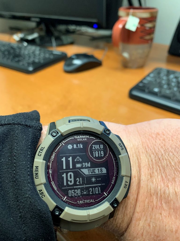
I considered two options. One was the Apple Watch and the other was Garmin and their many models. I liked the native Apple integration and I believe that they make quality products but it was the battery life that sealed the deal for me. The Garmin Instinct 2x has built in solar charging. You can see from the picture that the watch claims to currently have 39 days of charge.

The first model I considered was the Garmin Fenix. I am not sure what the total capabilities were, but it had a full color GPS screen in the watch face. When I looked at the cost of around $1000, I took a step back. What am I really asking a watch to do?

The Apple Watch is really a scaled down phone. In many ways, that appealed to me because I don’t like having to carry the phone around. That being said, this comes with a service cost. This means the cost of ownership perpetually grows. From a preparedness standpoint, it does give you duplicate capability. That is a good thing.

I am a believer in single purpose devices or tools. It is better to have a tool do the one thing it is intended to do well rather than three things marginal. If you can get the one thing well and the others marginal, that is better. Make sure to have another tool do those marginal tasks as well. So, a color GPS watch is cool, but is it really practical? I guess if I had money to burn I might choose the top of the line and just never use the feature. That is not really a position that I am in.

I am going to give an unvarnished opinion. I think the Garmin has the best features for fitness oriented people. If you want to track miles, and heart rate, etc this watch is for you. The Apple/Samsung watch is for people addicted to their phones. If you don’t fall into either of the groups, like me then wearables are a solution looking for a problem.

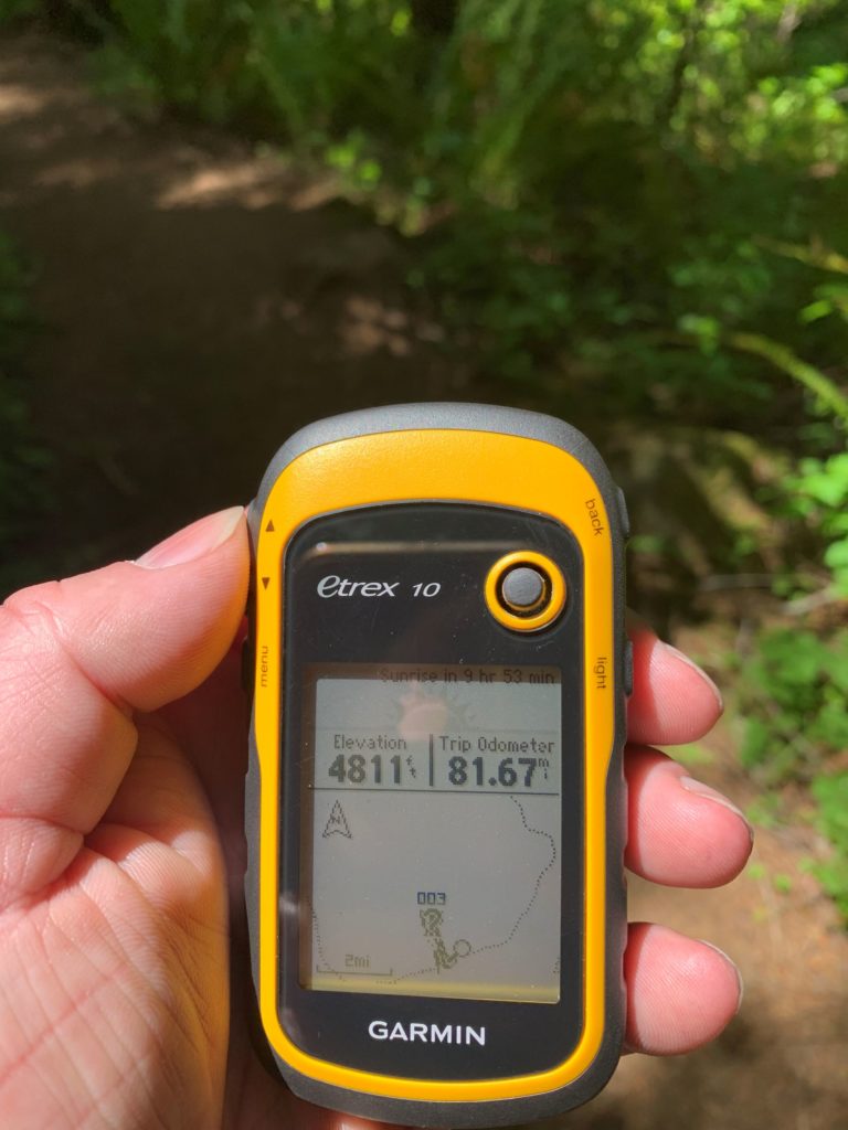
Like I stated in the opening, my wife wanted me to have the watch for her reasons. The selection and features I made were oriented toward my PCT hike. Maybe I will use it and maybe I wont. I plan on practicing with an actual GPS. In fact, I am looking into a satellite communicator integrated into a GPS device not just for the hike. Why would I carry a watch, a phone, a GPS and a satellite device? It definitely seems like overkill.

End Your Programming Routine: I have been wearing the watch for a couple of weeks now. I am still learning how to use it and optimize it. For instance every time my ring camera senses motion, it buzzes my wrist. Talk about annoying, but that is a subject for another day. I like seeing the weather, sunrise/sunset times and things on my wrist. The model name says ‘Tactical’ in it. That is totally worth the money. But really, it is an expensive toy.

June 12, 2024 – Technology…. Hooey

When you watch TV, you tend to get the impression that technology is infallible. About 15 years ago, we used to occasionally watch a cheesy show on Friday nights called “Las Vegas”. I would liken it to Baywatch based in a casino rather than the beach. James Caan played the lead on a casino security team and everything that happened jeopardized the world.

I remember one particular episode where the ‘bad guys’ were escaping and Caan runs to the control room and yells out ‘check the satellite imagery’. As if casino security could dial up satellite images in real time of their particular brand of problem. Just like CSI solves every crime in less than an hour, we are conditioned to believe that technology is readily available and is the solution to all of our problems.

I have been mulling over an upgrade to my handheld GPS device, especially since I am strongly leaning toward a PCT section hike next year. I am not as much interested in the GPS portion but the satellite communication capabilities. I feel like my wife has an unfounded fear of me going out into the wild by myself and I am hoping that something like that unlocks the door for me.

But, rather than having Toolbox Fallacy (I cant hike until I have this piece of gear) I might as well ‘run what I brung’. I took out my old Garmin eTrex 10. It doesn’t have two way satellite capability but I like the mileage capacity. And, I was hoping that it would get me in the habit of using it a little more. The last time I had it out was during hunting season last year.

I know that handheld GPS are now passé. The smart phone loads maps, it tracks your steps and things like that. Once you get rural here, phone signal is rare. I like to turn my phone into airplane mode so I don’t burn up the battery in case I really need it. Yes, technically GPS can still be used in airplane mode but I haven’t invested in services like OnX at this point. The old preparedness philosophy of two is one also applies. If you can afford the weight and space, purpose built devices usually provide better performance.

I forgot that I was even carrying it until I got halfway to the falls I was hiking. I take the batteries out of the device so that they do not leak all over and ruin the device. It is a good thing because one of the batteries failed. I didn’t realize that I have one more spare battery until I was messing with my pack and starting to head back. I felt it in the bottom as I was hitching it on my back.

So I finally got the device going. Except that, it never got signal with the satellite until I got back to my vehicle. All of the messing around I did really yielded no results. Based on the picture, my GPS was still stuck at the hunting location when the last batteries died. I know this because there was no way I was at 5000′ elevation.

The way I use this simple GPS would be to mark a waypoint at the vehicle or camp. That way I would have target from wherever I am at. But, since I didn’t do that, all I was really trying to do was track my mileage. These devices need to see a satellite. If you are in a canyon surrounded by mature trees, my experience says that connecting to a satellite is a tough sell. This is part of the reason I don’t use it all that often, it is not very useful other than hardcore bushwhacking with clear view to the southern sky. Those are two things that don’t go that well together.

I am not ready to throw the baby out with the bathwater yet. When I got home I did some research into updating the firmware. I am running the software it came with and often times significant performance improvements can be made by just running updates. That is a whole different post, but suffice to say I did it. Now, it is back to the trail to see if things work a little better.

It is as good as junk if I cannot use the GPS in 90% of the situations that I am trying to use it. An open field with a clear view of the horizon does not describe western Oregon outdoors. I certainly would not rely on it at this point. That is another fallacy that we have about technology. You just turn it on and problem solved. It takes practice and learning the ins and outs to make these devices useful.

End Your Programming Routine: One of the seminal events in my life was the family that followed their GPS unit into the snow and got terminally stuck. It has forever made me wary of blind faith in technology. This is no different, you have to use your brain when interpreting information, even with the satellite imagery at hand.